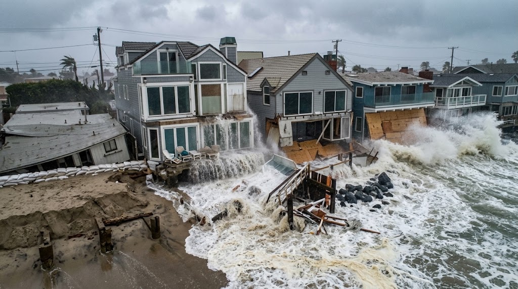
El Niño is strengthening in the tropical Pacific, and NOAA forecasts a very strong event during fall and winter 2026–27. For California, that pattern increases the odds of wetter-than-normal conditions, particularly across parts of Southern California, although El Niño does not guarantee heavy rain or flooding in every location.
The latest NOAA outlook also points to an unusually strong El Niño signal. During October–December 2026, NOAA’s Climate Prediction Center estimates a 75% chance that the event could reach historic strength compared with El Niño events in its record since 1950. At the same time, NOAA emphasizes that even a very strong El Niño does not guarantee a specific weather outcome in every region.
For California, the important questions are what this pattern could mean for winter rain, atmospheric rivers, flooding, Sierra Nevada snowpack, drought recovery, reservoirs, and water supplies.
What Is El Niño?
El Niño is a recurring climate pattern within the El Niño–Southern Oscillation, commonly called ENSO. It develops when ocean temperatures become unusually warm across parts of the tropical Pacific and the atmosphere responds to those changes.
Those ocean and atmospheric changes can influence the position of the jet stream and the paths followed by Pacific storms. Because California receives much of its annual precipitation during the cool season, changes in Pacific storm patterns can have important consequences for the state’s water supply and flood risk.
El Niño is not a storm or a single weather event. It is a large-scale climate pattern that changes the probability of certain seasonal conditions.
That distinction matters. A strong El Niño can increase the odds of wetter weather in California, but it cannot tell residents exactly when a storm will arrive, how much rain a particular city will receive, or whether a specific river will flood.
Why Does El Niño Matter for California?
California sits directly downstream of the Pacific Ocean, so changes in Pacific atmospheric circulation can affect the state’s winter weather.
During many El Niño winters, the subtropical jet stream and storm track shift in ways that favor wetter conditions across parts of the southern United States, including California. NOAA’s September 2026 seasonal outlook says the wet signal associated with El Niño extends across the southern half of California, while the odds of wetter-than-normal conditions increase across California during the winter outlook periods.
However, California is a large and geographically diverse state. Southern California, the Central Valley, the Sierra Nevada and Northern California can experience very different weather during the same winter.
That is why an El Niño forecast should be viewed as a seasonal probability rather than a guarantee of statewide rainfall.
What Is the 2026–27 El Niño Forecast?
NOAA’s Climate Prediction Center issued an El Niño Advisory on September 10, 2026. The agency reported that El Niño was strengthening and gave a greater than 90% chance of a very strong event during Northern Hemisphere fall and winter 2026–27.
NOAA also reported that sea-surface temperature anomalies in the eastern equatorial Pacific had exceeded 3°C in some areas, while the Niño-3.4 index reached +1.8°C in August. These measurements indicate that the oceanic component of El Niño had strengthened considerably.
The official ENSO outlook gives a 75% chance of a historic-strength event during October–December 2026, using NOAA’s relative oceanic Niño index and comparisons with events dating back to 1950.
A very strong El Niño generally increases confidence that typical El Niño-related patterns may occur. It does not, however, guarantee a particular amount of California rain or snow.
What Could El Niño Mean for California Rainfall?
The current NOAA seasonal outlook favors wetter-than-normal conditions across parts of California during the coming cool season.
For October through December 2026, NOAA’s outlook identifies a wet signal across the southern half of California. For later winter periods, the probabilities favoring wetter-than-normal conditions increase across California, with some coastal areas reaching probabilities in the 50% to 60% range.
This does not mean every storm will be unusually wet or that every California community will finish the winter above its average rainfall.
Seasonal outlooks are probability-based. They describe the odds of conditions being wetter, drier or near normal compared with the historical climate.
For residents, the practical message is simple: the background climate pattern may favor more opportunities for significant rain, but short-range weather forecasts remain essential for individual storms.
Southern California and El Niño
Southern California has historically shown one of the clearer relationships between El Niño and increased winter precipitation.
Los Angeles, San Diego, Orange County, Riverside, San Bernardino and Ventura County can experience substantial rainfall during active Pacific storm seasons. A favorable El Niño pattern can increase the opportunity for storms to reach the region.
More rain can be beneficial for soil moisture, vegetation and water resources, particularly following dry conditions.
But heavy precipitation can also create hazards. When rain falls rapidly, urban drainage systems can become overwhelmed, creeks and rivers can rise, and steep slopes can become unstable.
The same storm pattern that provides useful water can therefore create significant short-term risks.
Central California
Central California can also experience wetter conditions during a strong El Niño, but the response is less uniform than in Southern California.
The Central Coast, Central Valley and surrounding foothills can be affected by changes in the location and strength of Pacific storm tracks.
For agriculture and water management, additional precipitation can be useful when it arrives at the right time and can be stored or absorbed. However, intense rainfall can produce localized flooding, especially in low-lying areas and near rivers and drainage channels.
The Sierra Nevada is another major consideration because precipitation falling as snow can contribute to California’s water supply later in the year.
Northern California
Northern California’s relationship with El Niño is generally more variable.
That does not mean Northern California is unaffected. Strong Pacific storms and atmospheric rivers can still bring substantial precipitation, high winds and flooding to the region.
The final result depends heavily on the position of individual storm tracks and the presence of blocking high-pressure systems.
As a result, residents in Northern California should not assume that El Niño automatically means either a very wet or very dry winter.
Could El Niño Increase Atmospheric River Risks?
El Niño does not directly create every atmospheric river.
Atmospheric rivers are long, narrow corridors of concentrated water vapor that can transport large amounts of moisture toward the West Coast. When they make landfall, they can produce intense precipitation, especially when moisture-rich air encounters California’s mountains.
During an El Niño winter, changes in Pacific circulation can affect where storms and moisture move. That can increase the potential for significant precipitation events in parts of California.
The risk becomes more serious when several storms arrive close together.
One heavy storm may cause temporary flooding. A sequence of storms can leave soils saturated, raise river levels and increase the chance that another round of rain will produce more severe impacts.
California Flood Risk During El Niño
A wetter seasonal outlook does not mean California will flood throughout the winter.
Flood risk depends on several factors, including:
- How much rain falls during individual storms
- How quickly the rain arrives
- Soil moisture before the storm
- River and reservoir levels
- Urban drainage capacity
- Terrain and elevation
- Burn scars from recent wildfires
- Snow levels during major storms
- The number of storms arriving close together
This is why residents should pay more attention to specific flood watches and warnings than to the El Niño label alone.
A seasonal forecast can indicate a greater chance of wet conditions months in advance. A short-range forecast provides much more useful information about whether a particular storm could create dangerous flooding.
What Could El Niño Mean for Sierra Nevada Snowpack?
California’s snowpack is an important natural water-storage system.
Snow that accumulates in the Sierra Nevada during winter can melt gradually during spring and summer, supplying water to rivers, reservoirs and ecosystems.
A wet El Niño winter could increase precipitation in the Sierra Nevada, but total precipitation does not automatically translate into more snow.
Temperature matters.
If storms are unusually warm, some precipitation that might otherwise fall as snow can fall as rain at higher elevations. That can reduce snowpack even when total winter precipitation is high.
For California’s long-term water supply, the combination of precipitation, snow level, snowpack depth, runoff timing and reservoir storage matters more than rainfall totals alone.
Can El Niño End California Drought?
El Niño can help improve drought conditions, but it should not be considered a guaranteed drought solution.
A wet winter can increase soil moisture, improve reservoir inflows and contribute to groundwater recharge. Snow accumulation in the Sierra Nevada can also provide additional water later in the year.
However, drought recovery depends on how much precipitation falls, where it falls, whether it is stored, how much evaporates or runs off, and how much water remains available after winter.
A few very intense storms may produce impressive rainfall totals without creating the same long-term water benefits as a season with well-distributed precipitation and strong snowpack.
For that reason, El Niño can improve California’s water outlook without automatically eliminating drought.
El Niño vs. La Niña in California
| Climate pattern | Pacific conditions | Possible California tendency |
|---|---|---|
| El Niño | Warmer-than-average tropical Pacific waters | Increased odds of wetter conditions, especially across parts of Southern California |
| La Niña | Cooler-than-average tropical Pacific waters | Often associated with drier conditions in Southern California, while Northern California remains more variable |
| ENSO-neutral | Neither El Niño nor La Niña dominates | Other atmospheric and oceanic patterns may have a larger influence |
These are broad tendencies rather than rules.
California’s weather can differ substantially from the historical pattern during any individual ENSO event.
Which California Areas Should Pay Attention?
Southern California
Southern California may have the strongest reason to monitor the developing wet-season pattern because NOAA’s outlook shows a clear wet signal across the southern part of the state.
Residents should monitor forecasts for heavy rain, urban flooding, debris flows, coastal hazards and travel disruptions during major storms.
Central California
Central California should watch both water benefits and flood hazards.
Additional precipitation can support water resources and agriculture, but intense storms can cause flooding in the Central Valley and surrounding areas.
Sierra Nevada
The Sierra Nevada requires particular attention to snow levels.
A storm that produces heavy mountain precipitation can have very different water-supply consequences depending on whether that precipitation falls as snow or rain.
Northern California
Northern California should continue monitoring atmospheric river forecasts and individual storm tracks.
The El Niño signal is not equally strong across every part of the state, so local forecasts remain more useful for determining immediate risks.
How El Niño Could Affect California Water Supplies
California’s water system depends on more than one winter rainfall total.
Important factors include:
- Sierra Nevada snowpack
- Reservoir storage
- Groundwater recharge
- River runoff
- Soil moisture
- Temperature
- The timing of precipitation
- Water demand during the following warm season
A wet winter can improve several of these factors, but the benefits depend on how precipitation is distributed.
For example, a series of moderate storms with substantial mountain snow can have different long-term effects from a few very warm storms that produce intense rainfall and rapid runoff.
That distinction is especially important when assessing California’s water outlook.
What Should California Residents Watch?
Residents should use different forecasts for different decisions.
NOAA Climate Prediction Center: Useful for seasonal climate outlooks and ENSO updates.
National Weather Service: More useful for individual storms, flood watches, warnings, high winds and other immediate hazards.
California water agencies: Useful for information about reservoirs, snowpack, runoff and statewide water conditions.
Local emergency-management agencies: Important for evacuation information, local flood risks, debris-flow warnings and emergency alerts.
The key distinction is that an El Niño forecast describes the broader seasonal pattern, while a local weather warning tells you what may happen in your area in the next several hours or days.
How to Prepare for a Wet California Winter
Preparation is easier before a major storm arrives.
Clear Gutters and Drainage
Remove leaves, branches and other debris from gutters, downspouts and nearby drainage areas.
Make sure water has a clear path away from your home.
Know Your Flood Risk
If you live near a river, creek, canyon, low-lying area or recent wildfire burn scar, understand the hazards in your area.
Know where local evacuation routes are located before an emergency occurs.
Prepare an Emergency Kit
Keep basic emergency supplies available, including drinking water, food, flashlights, batteries, phone chargers and important documents.
Sign Up for Emergency Alerts
Local emergency alerts can provide more immediate information than a seasonal forecast.
Avoid Flooded Roads
Never assume a flooded road is safe because the water appears shallow.
Moving water can hide road damage and create dangerous driving conditions.
Pay Attention to Burn Scars
Areas affected by recent wildfires can be especially vulnerable to debris flows during heavy rainfall.
Residents near burn scars should pay close attention to local warnings during significant storms.
Common El Niño Misunderstandings
Does El Niño Mean California Will Definitely Flood?
No.
El Niño can increase the probability of wetter conditions, but flooding depends on individual storms, rainfall intensity, terrain, soil conditions and other factors.
Does a Strong El Niño Guarantee Drought Relief?
No.
A wet winter can improve water conditions, but drought recovery also depends on snowpack, groundwater, reservoirs and the timing of precipitation.
Does Strong El Niño Mean Nonstop Storms?
No.
Even during a very wet winter, California can experience dry periods between major storms.
Does El Niño Guarantee More Sierra Snow?
No.
The amount of snow depends partly on storm temperatures and snow levels. A very wet winter can still produce less snow than expected if storms are unusually warm.
Is El Niño the Same as Climate Change?
No.
El Niño is a naturally recurring climate pattern involving the tropical Pacific Ocean and atmosphere. Climate change refers to longer-term changes in Earth’s climate system.
The two can influence weather conditions at the same time, but they are not the same phenomenon.
What the 2026–27 El Niño Could Mean for California
The current outlook points toward a potentially significant El Niño winter.
NOAA says there is a greater than 90% chance of a very strong El Niño during fall and winter 2026–27. Its September seasonal outlook also favors wetter-than-normal conditions across parts of California, with the wet signal becoming more pronounced during the winter outlook periods.
That creates both potential benefits and risks.
More precipitation could improve soil moisture, reservoir inflows and snowpack if temperatures are favorable for mountain snow. At the same time, intense storms could increase the risk of flooding, debris flows, coastal hazards and travel disruptions.
The most useful way to think about El Niño California forecasts is therefore not as a promise of a wet winter, but as a shift in the odds.
Frequently Asked Questions
What does El Niño mean for California?
El Niño changes Pacific Ocean and atmospheric circulation in ways that can increase the odds of wetter conditions across parts of California, particularly Southern California. It does not guarantee a specific amount of rainfall.
Is El Niño good for California’s drought?
It can help improve drought conditions through additional rain and snow, but the overall effect depends on precipitation timing, snowpack, groundwater recharge and reservoir storage.
Will El Niño bring more rain to Southern California?
The current NOAA outlook favors wetter-than-normal conditions across the southern half of California. Southern California also has a relatively strong historical relationship with El Niño-related winter precipitation.
Does El Niño cause atmospheric rivers?
El Niño does not directly create every atmospheric river. Instead, the broader circulation pattern can influence Pacific storm tracks and moisture transport, which can affect the potential for major atmospheric-river events.
How strong is the 2026–27 El Niño expected to be?
NOAA’s September 2026 outlook gives a greater than 90% chance of a very strong El Niño during Northern Hemisphere fall and winter 2026–27. It also gives a 75% chance of a historic-strength event during October–December 2026 under its stated RONI-based definition.
Will Northern California also get more rain?
Northern California can experience major storms during an El Niño winter, but the relationship is more variable than in Southern California. Individual storm tracks and atmospheric rivers can have a major influence on seasonal rainfall.
What should Californians do before winter?
Residents should check local flood risks, clear drainage systems, prepare emergency supplies, sign up for local alerts and monitor National Weather Service forecasts during major storms.
Final Takeaway
The 2026–27 El Niño is strengthening, and NOAA currently expects a very strong event during the Northern Hemisphere fall and winter. The seasonal outlook favors wetter-than-normal conditions across parts of California, particularly the southern half of the state.
For California, that could mean valuable rain, improved water conditions and potentially stronger mountain snowpack. It could also mean periods of intense rainfall, flooding, debris flows and other storm-related hazards.
The most important point is that El Niño changes probabilities rather than guaranteeing outcomes. Seasonal forecasts provide the big picture, while short-range weather forecasts determine the immediate risks.
For the latest conditions, residents should continue checking NOAA and National Weather Service updates as the 2026–27 winter develops.
